



| IN A NUTSHELL |
|
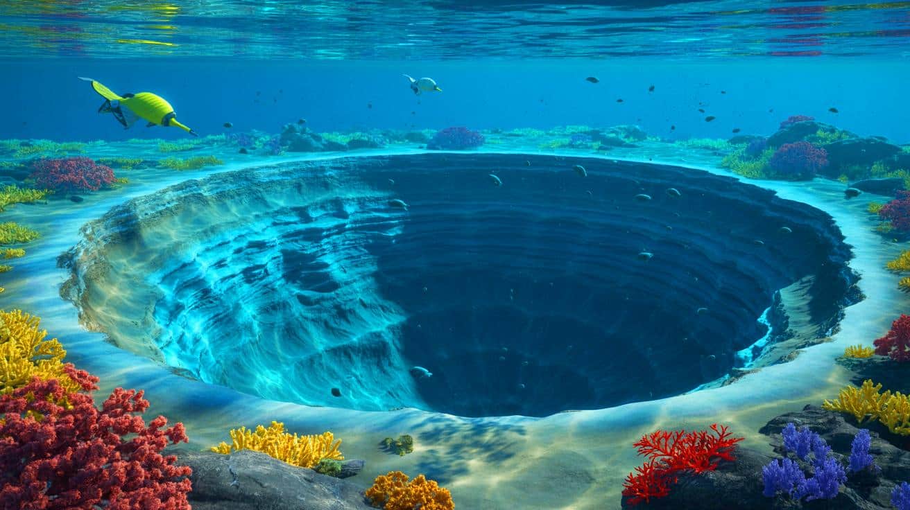
The recent discovery of a massive asteroid impact crater deep beneath the Atlantic Ocean has sparked widespread interest among geologists and planetary scientists. Named the Nadir Crater, this underwater marvel measures approximately 5.6 miles in diameter and lies about 1,000 feet below the ocean floor. The crater’s formation dates back roughly 66 million years, coinciding with the catastrophic Chicxulub impact thought to have led to the extinction of the dinosaurs. The new findings, published in Nature Communications Earth & Environment, offer a unique opportunity to explore the mechanics of such an ancient and colossal event.
Unveiling the Nadir Crater: A Geological Gem
The Nadir Crater was first identified by Dr. Uisdean Nicholson from Heriot-Watt University. While examining seismic reflection data off the coast of Guinea in West Africa, he found a circular depression spanning over 8.5 kilometers. This led him to suspect it was the result of an ancient asteroid strike. Collaborating with experts in planetary science and geology from the UK and the USA, Dr. Nicholson sought to confirm his suspicions. Early analyses suggested the crater was formed by an asteroid several hundred meters wide about 66 million years ago.
Confirmation came with the use of advanced 3D seismic imaging techniques. The crater’s formation process now stands as a testament to the formidable power of asteroid impacts. Molten rock surged upward upon impact, and a vast zone of fractured rock extended for thousands of square miles. Additionally, a colossal tsunami, over 2,600 feet high, swept across the Atlantic, illustrating the catastrophic aftermath of the event. These insights offer a vivid picture of the Earth’s geological history and underscore the potential consequences of such impacts.
Technological Advances in Seismic Imaging
The leap from traditional 2D imaging to high-resolution 3D seismic data has revolutionized our understanding of the Nadir Crater. Dr. Nicholson likened this advancement to the difference between grainy ultrasound images of the past and the detailed 3D images used in modern medical imaging. The new data allows scientists to explore the crater in unprecedented detail, peeling back layers of sedimentary rock to reveal the crater’s structure at various levels.
These technological advancements are not just a leap forward for geological research but also provide a glimpse into the future of planetary science. The ability to capture such detailed images of a marine impact crater is a rare opportunity, as there are only about 20 confirmed marine craters worldwide. This level of detail allows researchers to test hypotheses about crater formation and develop new models that could be applied to both Earth and other celestial bodies, enhancing our understanding of impact processes on a global scale.
Reconstructing the Catastrophe: Minute-by-Minute Analysis
The 3D seismic data has enabled researchers to piece together a timeline of events immediately following the Nadir impact. Initially, the crater formed as a deep bowl, with soft sediments flowing inward to create a visible “brim.” The seismic activity caused by the impact liquefied sediments below the seabed, leading to fault formation and massive landslides as the plateau margin collapsed into the ocean. Additionally, evidence of a series of tsunami waves further illustrates the extent of the catastrophe.
The data also provides insights into the asteroid’s trajectory and speed. Researchers now estimate the asteroid was between 1,475 and 1,640 feet wide, traveling at approximately 20 kilometers per second, or 72,000 kilometers per hour. These findings not only enhance our understanding of the Nadir event but also contribute to our knowledge of asteroid impacts and their potential threats to Earth.
Implications for Future Research and Planetary Defense
The discovery of the Nadir Crater offers a unique natural laboratory for studying asteroid impacts. With plans to drill into the seabed and recover cores from the crater, researchers hope to gain more information about the shock pressures experienced during impact and the precise sequence of events that followed. This research could have significant implications for planetary defense strategies, as it provides a rare opportunity to study the effects of large asteroid impacts on Earth.
While the Nadir Crater is a relic of the past, the threat of asteroid impacts remains a concern for the future. The rubble pile asteroid Bennu, for example, is considered the most hazardous object in near-Earth orbit, with a small but notable impact probability. Understanding the dynamics of past asteroid impacts is crucial for developing effective measures to protect our planet from future threats.
The discovery of the Nadir Crater not only enriches our understanding of Earth’s geological history but also underscores the importance of ongoing research in planetary science and impact studies. As we delve deeper into the mysteries of our planet and its celestial neighbors, we are continually reminded of the dynamic forces that shape our world. How might these insights influence our approach to planetary defense and our understanding of Earth’s place in the cosmos?


Wow, a 5-mile wide crater! That’s like the size of a small town. 😮
Amazing discovery! How long did it take to map the crater with 3D imaging? 🚀
Is it possible there are more hidden craters like this under the ocean?
Wait, so this is another crater from the same time as Chicxulub? Just how many asteroids were flying around back then? 😅
This is fascinating! I love learning about Earth’s history through geology. Thanks for sharing!
Can we visit the site? Would love to see it in person!
So, are we any closer to predicting future asteroid impacts with this research?
This is fascinating! How does this discovery affect our understanding of the dinosaur extinction event?
I’m skeptical. How can we be sure this crater is 66 million years old?
Great article! I’m curious, how do you differentiate between asteroid and comet impacts? 🤔
I can’t believe a tsunami over 2,600 feet high happened. That’s mind-blowing! 🌊
Spelling error in paragraph 3. “Colosall” should be “colossal”.
What tools do scientists use for 3D seismic imaging? Sounds high-tech!