


| IN A NUTSHELL |
|
In the ever-evolving landscape of environmental science, the ability to track and predict the movement of wildfire smoke has become increasingly crucial. The University of Minnesota Twin Cities has pioneered a solution that could transform our understanding of smoke behavior: a swarm of AI-powered drones. These drones are designed to enter smoke plumes, capturing high-resolution images and data to construct detailed 3D models. This innovative approach promises to advance our knowledge of how smoke particles move and linger in the atmosphere, potentially improving air quality forecasts and disaster response strategies. The implications of this research extend beyond wildfires, offering insights into other particle-driven phenomena.
A Growing Crisis Meets High-Tech Tools
In recent years, the United States has seen an increase in the use of prescribed burns—controlled fires intended to improve forest health and mitigate the risk of uncontrolled wildfires. Between 2012 and 2021, approximately 50,000 prescribed burns were conducted. However, even these controlled efforts are not without risks. According to a 2024 report by the Associated Press, 43 of these burns escalated into wildfires. This statistic, while small in percentage, underscores the importance of understanding smoke dynamics.
Smoke particles, especially smaller ones, pose significant challenges. They can remain airborne for days, traveling far from their original source and affecting air quality over large distances. Understanding the composition and dispersion of these particles is critical for effective public health and safety strategies. Traditional methods like satellites and Lidar often fall short in providing the necessary detail and flexibility, especially in remote or rugged terrains. This is where the new drone swarm technology comes into play, offering a more nuanced and real-time data collection capability.
“A key step is understanding the composition of smoke particles and how they disperse,” explained Jiarong Hong, professor of mechanical engineering at the University of Minnesota and senior author of the study.
https://www.sustainability-times.com/research/scientists-resurrect-2500-year-old-tamil-faces-digital-technology-reveals-shocking-genetic-links-between-ancient-keeladi-civilization-and-modern-south-indians/
The Science Behind the Swarm
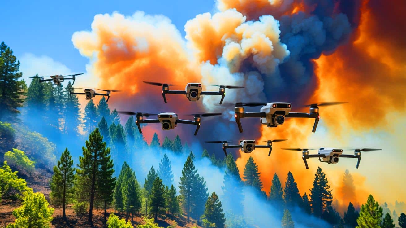
The drone system developed by the University of Minnesota research team comprises a manager drone and four worker drones. These are not merely flying cameras; they are sophisticated airborne laboratories. Each drone is equipped with a 12-megapixel camera mounted on a three-axis gimbal, allowing for dynamic image capture. Advanced flight controllers and NVIDIA Jetson processors help the drones recognize smoke and adjust their flight paths in real time.
Once deployed, these drones collaborate to fly around a smoke plume, capturing high-resolution images from multiple angles. These images are then processed using a Neural Radiance Field (NeRF) model to construct a comprehensive 3D representation of the smoke plume. This capability allows researchers to analyze the plume’s shape, flow, and dispersion, providing critical data that can enhance fire behavior models and air quality predictions.
While other AI techniques were considered, the drone swarm approach offers distinct advantages. It collects high-resolution data efficiently and at a lower cost than satellite-based methods. As Nikil Nrishnakumar, the study’s first author, noted, this approach facilitates real-time data collection across extensive areas, providing a practical solution for smoke monitoring.
From Research to Real-World Impact
The drone swarm has already been tested in field deployments with promising results. By creating time-lapse 3D reconstructions of smoke plumes, researchers can observe the evolution of smoke in real-time. This capability is invaluable not only for wildfire science but also for monitoring other environmental hazards such as volcanic eruptions and dust storms.
The modular and cost-effective nature of the drone system makes it adaptable for various applications. It can be scaled to suit different monitoring needs, offering potential use by government agencies, environmental researchers, and emergency response teams. The research team is also working on integrating fixed-wing drones with Vertical Takeoff and Landing (VTOL) capabilities to extend the monitoring range.
Future developments include exploring Digital Inline Holography to enhance particle characterization, providing even more detailed insights into smoke plume composition. As Nrishnakumar stated, this research lays the foundation for smarter and more responsive environmental hazard management systems.
A New Era of Smoke Science
Current simulation tools, like FIRETEC and QUIC-Fire, rely on complex inputs to model fire spread and smoke behavior. These models require accurate, real-world data to validate their predictions. The drone swarm provides this critical data, offering high-resolution, time-sensitive information that can refine and enhance simulation models.
By creating accurate 3D ground truth models, the drones enable comparisons between predicted and actual smoke movements, even in challenging environments. As climate change increases wildfire risks, tools like these will be essential for safeguarding ecosystems and human health. With over 40% of the U.S. population living in areas susceptible to wildfire smoke, the importance of this research is clear.
This innovative project received support from the National Science Foundation and involved contributions from researchers at the Minnesota Robotics Institute. The research team, led by Jiarong Hong and Nikil Nrishnakumar, is paving the way for improved environmental monitoring technologies.
The advancement of AI-powered drone technology marks a significant step forward in atmospheric science. By providing real-time, detailed data on smoke dispersion, these drones may revolutionize our ability to predict and respond to environmental hazards. As the team continues to refine and expand their system, one key question remains: how will these technological breakthroughs shape our future approach to environmental challenges and disaster management?




Wow, this sounds like something out of a science fiction movie! 🚁
Wow, AI drones creating 3D smoke models? We’re living in a sci-fi movie! 🚀
Are these drones safe for wildlife? 🦉
Can these drones handle harsh weather conditions while flying into smoke plumes?
How do fire chiefs feel about having AI drones in their airspace?
Would love to see some of these 3D models in action! Where can I find them?
Thank you for the informative article. This tech sounds promising for wildfire management.
Isn’t it ironic that we’re using tech to deal with fires, which are often started by tech failures?
Is there a risk of these drones getting damaged or lost in the smoke?
This is incredible. Technology is truly changing the way we fight wildfires.
Can’t wait for the day when drones put out the fires instead of just watching them. 🔥
Interesting idea, but are fire chiefs really terrified or just cautious? 🤔
How much does it cost to deploy a swarm of these drones?
How do these drones compare to satellite data collection in terms of accuracy?
Sounds like an episode of Black Mirror, but in a good way. 😅
It’s amazing how far drone technology has come in just a few years!
It’s amazing what technology can do nowadays! Keep up the good work. 👍
Do these drones have any environmental impact themselves?