| IN A NUTSHELL |
|
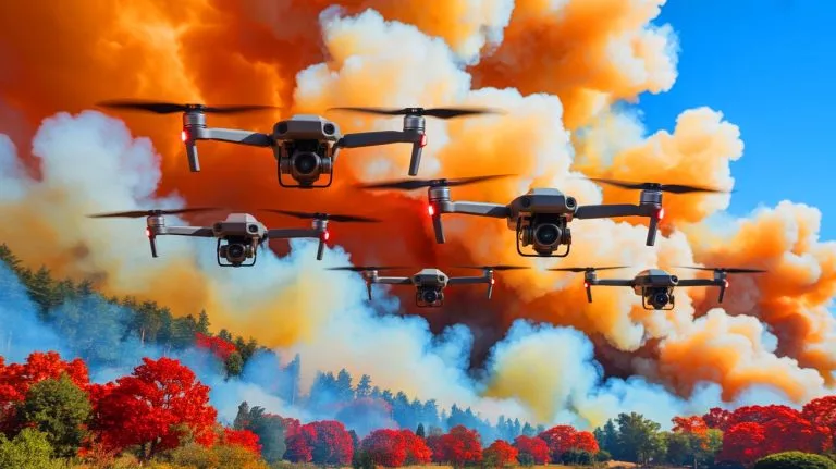
In recent years, the challenge of accurately predicting the movement of wildfire smoke plumes has grown increasingly urgent. As wildfires become more frequent and intense, the need for precise data on smoke behavior has never been more critical. Researchers at the University of Minnesota Twin Cities have developed a groundbreaking solution: a swarm of AI-powered aerial robots that can track and map smoke plumes in real-time. This innovative approach promises to revolutionize our understanding of smoke dynamics and improve air quality predictions, offering a potential new tool in the fight against the damaging effects of wildfires.
Understanding Smoke Dynamics
Wildfire smoke can travel extensive distances, impacting air quality in areas far removed from the actual fire. Traditional methods of tracking these smoke plumes, such as satellite imaging, often lack the resolution needed for precise data collection. The new aerial robots developed by the University of Minnesota aim to fill this gap. These drones are equipped with advanced sensors and artificial intelligence, enabling them to fly directly into smoke plumes and gather detailed data. By building three-dimensional reconstructions of plumes, the drones provide insights into how smoke particles move and disperse over long distances.
Jiarong Hong, a professor in the Department of Mechanical Engineering, highlights the importance of understanding smoke particle composition. Smaller particles can remain airborne for extended periods, traveling hundreds of miles from the fire source. This phenomenon underscores the need for detailed data to enhance air quality models. The drones’ ability to collect high-resolution data across large areas offers a significant advantage over existing satellite-based methods, providing critical information for improving atmospheric simulations and informing hazard response strategies.
Data to Improve Fire Response
The development of these aerial robots comes at a crucial time. From 2012 to 2021, prescribed burns in the United States led to 43 wildfires, emphasizing the need for better smoke management tools. Previous modeling systems have struggled with data accuracy and field observations, leaving gaps in our understanding of fire and smoke behavior. The Minnesota research team’s coordinated system addresses these deficiencies by tracking plumes in real-time and producing comprehensive flow pattern analyses.
This innovative approach also incorporates Digital Inline Holography for particle characterization, enhancing predictive models that guide response efforts during wildfires. The potential applications of this technology extend beyond wildfires to include monitoring other airborne hazards, such as sandstorms and volcanic eruptions. The researchers’ goal is to develop this system into a practical tool for early fire detection, emphasizing the importance of early identification in improving response times and mitigating damage.
Building on Earlier Drone Systems
Prior to this project, the research team had already developed autonomous drones with computer vision capabilities for following smoke plumes. The current system expands on this foundation by incorporating multiple drones in a coordinated tracking effort. The team is also exploring the use of fixed-wing VTOL (Vertical Take-Off and Landing) drones, which offer the advantage of longer flight endurance and are better suited for covering wide areas.
The collaborative effort includes contributions from experts at the Minnesota Robotics Institute and resources from the St. Anthony Falls Laboratory. By integrating robotics and environmental science, the researchers are creating cost-effective tools that enhance data collection capabilities. Improved smoke tracking can help communities and agencies respond more quickly to wildfire threats, potentially reducing health impacts associated with airborne particles.
Future Prospects and Challenges
While the aerial robot system shows immense promise, several challenges remain. The integration of these drones into existing fire response frameworks will require collaboration with governmental and environmental agencies. Moreover, ensuring the reliability and accuracy of the collected data is crucial for the system’s success. The researchers are optimistic about overcoming these hurdles and envision a future where real-time smoke tracking becomes an integral part of wildfire management strategies.
As the team continues to refine and test their system, they are also exploring potential commercial applications for their technology. The ability to monitor and predict the movement of airborne particles has implications for industries beyond firefighting, including agriculture and environmental protection. The question remains: how will these advancements in drone technology reshape our approach to managing and mitigating the impact of wildfires in the coming years?
Did you like it? 4.4/5 (28)


Wow, this sounds like something out of a sci-fi movie! 🚁
Wow, this technology sounds like something out of a sci-fi movie! 🚀
How do they ensure these drones don’t collide with each other while flying in a swarm?
How do these drones handle adverse weather conditions? Seems like a tough environment!
Can these drones be used in other countries prone to wildfires, like Australia?
Great job, University of Minnesota! We need more innovative solutions like this. 🌟
I’m curious about the cost. How expensive is it to deploy this drone swarm?
Isn’t it risky for drones to fly so close to active wildfires?
Looks like we’re finally getting some high-tech help in fighting wildfires! 🔥
Can these drones also be used for other purposes, like monitoring pollution in cities?